

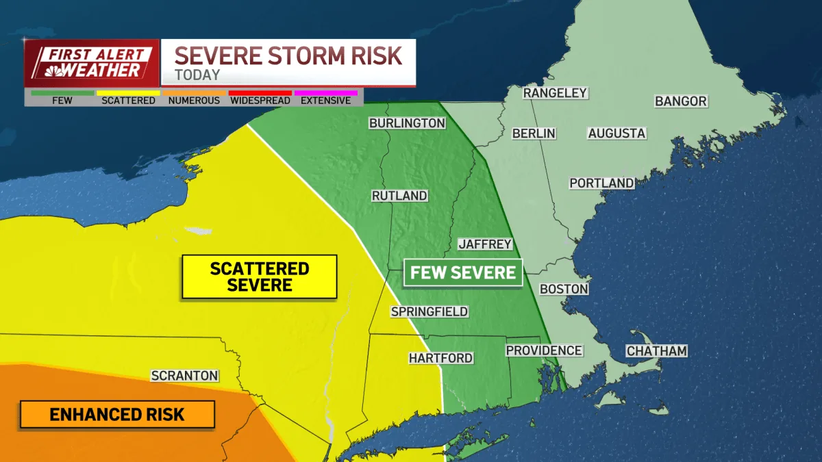
BOSTON, MA — Severe storms moved through New England on Tuesday, bringing flash-flood warnings, scattered power outages and a weather delay for the Red Sox. By late night, the main warnings had expired, but forecasters said the region would still see unsettled conditions into Thursday.
Massachusetts, Rhode Island and Connecticut all faced flash-flood warnings during the day, along with severe thunderstorm warnings and a tornado watch in Connecticut. Officials also reported more than 2,000 Massachusetts customers without power at one point, with more than 1,600 still out by midnight.
Why did the weather cause such a disruption?
Forecasters said the area did not get much sun, which limited the extra energy storms often need to intensify. Even so, they said the severe threat was not zero, especially west of Worcester.
The strongest risk, rated level three out of five, was expected farther west in Pennsylvania and New York rather than across most of the Boston area.
How did the storms affect power and travel?
Massachusetts emergency managers reported outages as the system moved through the state. The peak outage count topped 2,000 customers before dropping later in the night.
Weather conditions also disrupted baseball. The Red Sox had Tuesday’s game postponed, and the team was set for a Wednesday doubleheader with a chance to extend or tie a club winning streak.
What weather conditions were expected after midnight?
Forecasters said the storms were expected to wind down after midnight, but winds would remain gusty. In Boston, wind gusts were expected to reach near 40 mph.
That wind was also expected to push wildfire smoke back over the region, lowering air quality to moderate. Forecasters said people with asthma, along with children and older adults, could notice the change.
What comes next for New England this week?
A warm front was expected to lift temperatures into the mid-80s on Wednesday before a cold front arrived Wednesday evening. That front could trigger more storms before the region cools down again.
By Thursday, forecasters expected highs in the upper 70s, followed by a stretch of fresher weather with sea breezes moving in and out of the area.
Bronxville News keeps New York and the region covered, day and night.