

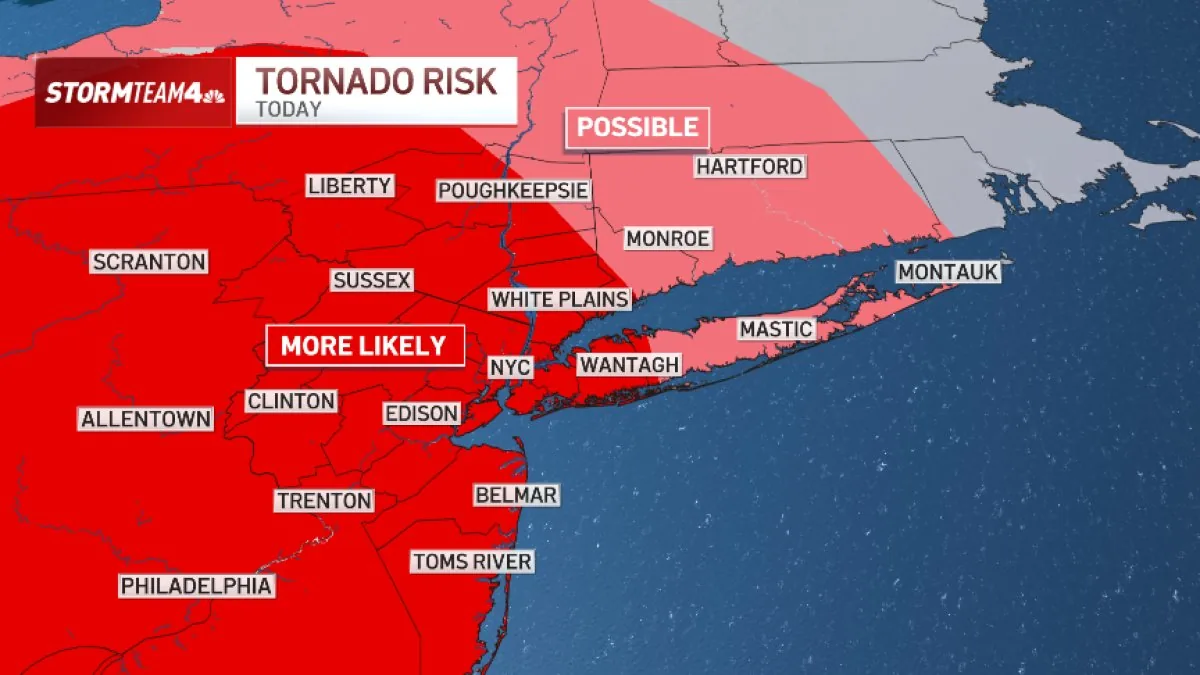
NEW YORK, NY — Severe thunderstorms are expected to move across the tri-state area again Tuesday, bringing another round of damaging weather after weekend storms already caused flash flooding and tornado alerts.
Forecasters said the morning may start with only isolated storms, but conditions should become more dangerous from midday into the evening as two separate waves of rain and thunder pass through.
What are the main hazards in Tuesday's storm setup?
The primary concern is damaging straight-line wind, with gusts of 58 mph or higher possible. Forecasters also warn of isolated flash flooding, especially where storms repeatedly train over the same area.
Hail remains a secondary threat, along with brief spin-up tornadoes that could form quickly in the strongest cells.
Where is the worst weather expected to develop?
Storms are expected to be strongest west of New York City, where the risk of hail and tornadoes is greatest. As the system moves east, forecasters say the storms should weaken somewhat, though the hazards will not disappear entirely.
The entire tri-state region remains under a moderate risk for severe weather, according to the forecast summary.
Why is flooding a bigger concern in central and South Jersey?
Central and South Jersey face the highest flash-flood risk because those areas are expected to see the heaviest rain and the greatest chance for water to pool quickly on roads and in low-lying spots.
Even so, officials and forecasters are cautioning that flooding could still affect the broader region if storms become more intense or move more slowly than expected.
How does Tuesday's forecast compare with Saturday's storms?
The Tuesday storm threat is being compared with Saturday’s severe weather, which brought powerful thunderstorms, flash floods and tornado warnings across the region.
One difference, forecasters said, is that Tuesday’s storms are expected to move faster than the weekend system, although they still may be strong enough to produce wind damage, hail and brief tornadoes.
Bronxville News keeps New York and the region covered, day and night.