

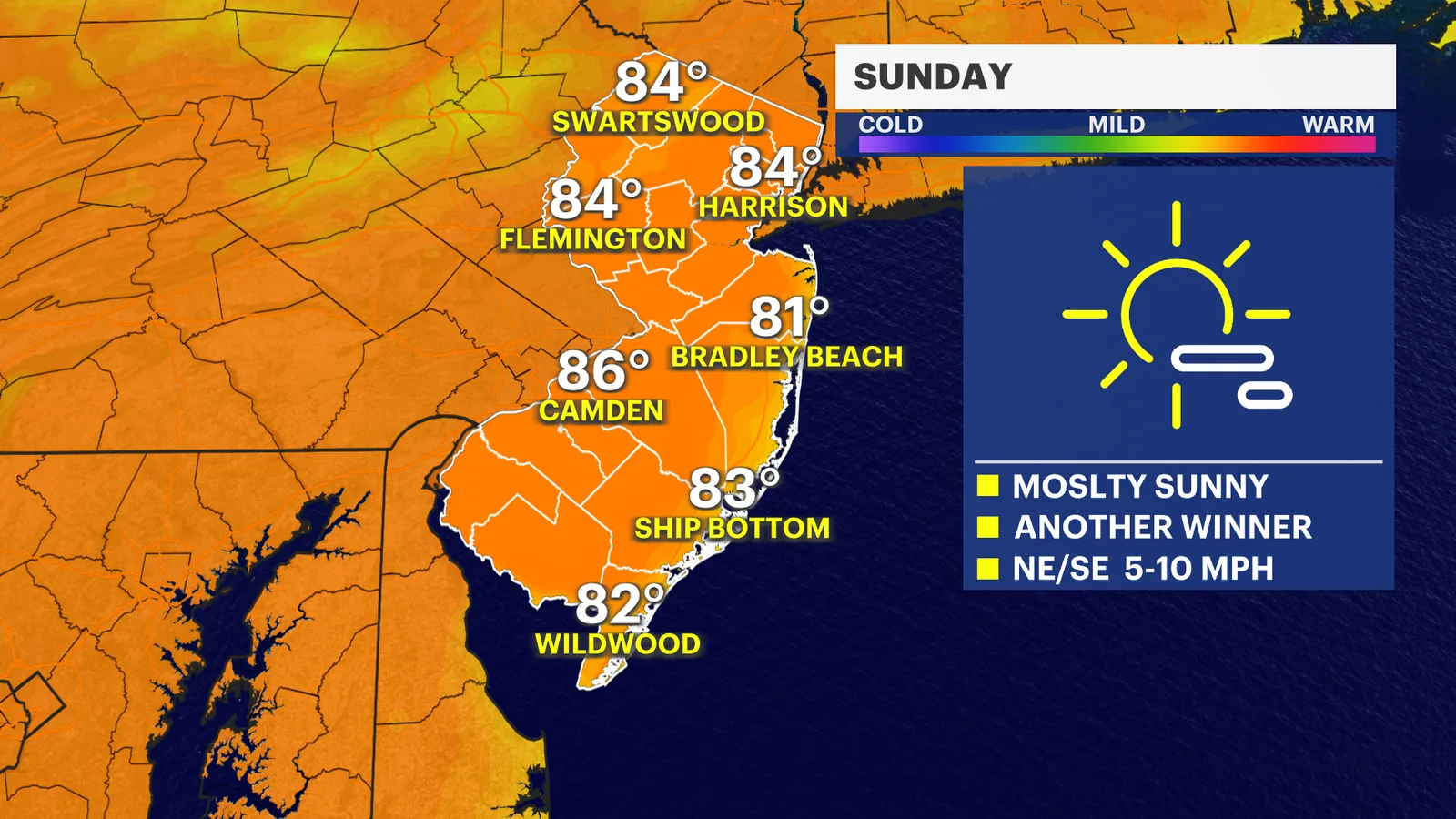
NEW YORK, NY — Mostly sunny skies are expected to remain in place across New Jersey through the weekend, with high pressure sliding off the Northeast coast. Temperatures should stay a few degrees below the typical mid-80s average, and humidity will remain low enough to keep conditions feeling comfortable.
The stretch of pleasant weather is projected to continue into Monday, when a mix of sun and clouds is forecast. It is a brief pause before a more active pattern arrives later in the week.
What will Sunday and Monday feel like across New Jersey?
Sunday should bring continued sunshine and warm but not overly hot conditions. The air is expected to stay relatively dry, which will make the temperatures feel less oppressive than many July days in the region.
Monday is forecast to look similar overall, though clouds may increase at times. Even with that change, the day is still expected to stay on the pleasant side before the next storm system approaches.
Why are forecasters expecting a change by Tuesday?
By Tuesday, the weather pattern is expected to turn more active as showers and thunderstorms move into the state. The shift follows the departure of the high-pressure system that has been keeping the atmosphere stable.
That setup can open the door to unsettled weather, and forecasters are watching for storms that may build more quickly once conditions become favorable.
How serious could the incoming storms become?
The News 12 Storm Watch Team says a few of the storms could strengthen and become severe. The forecast is still evolving, and details may change as the system gets closer and is tracked more closely.
At this point, the main message is that Tuesday appears to be the start of a more hazardous stretch compared with the quiet, sunny pattern early in the week.
What should New Jersey residents watch next?
Residents should keep an eye on updated forecasts heading into Tuesday, especially if outdoor plans are set for the start of the workweek. The timing, coverage and intensity of the showers and thunderstorms will become clearer as the weather system nears.
Forecasters say they will continue to update the outlook as new information comes in, particularly if storm strength or timing trends change.
Bronxville News keeps New York and the region covered, day and night.