

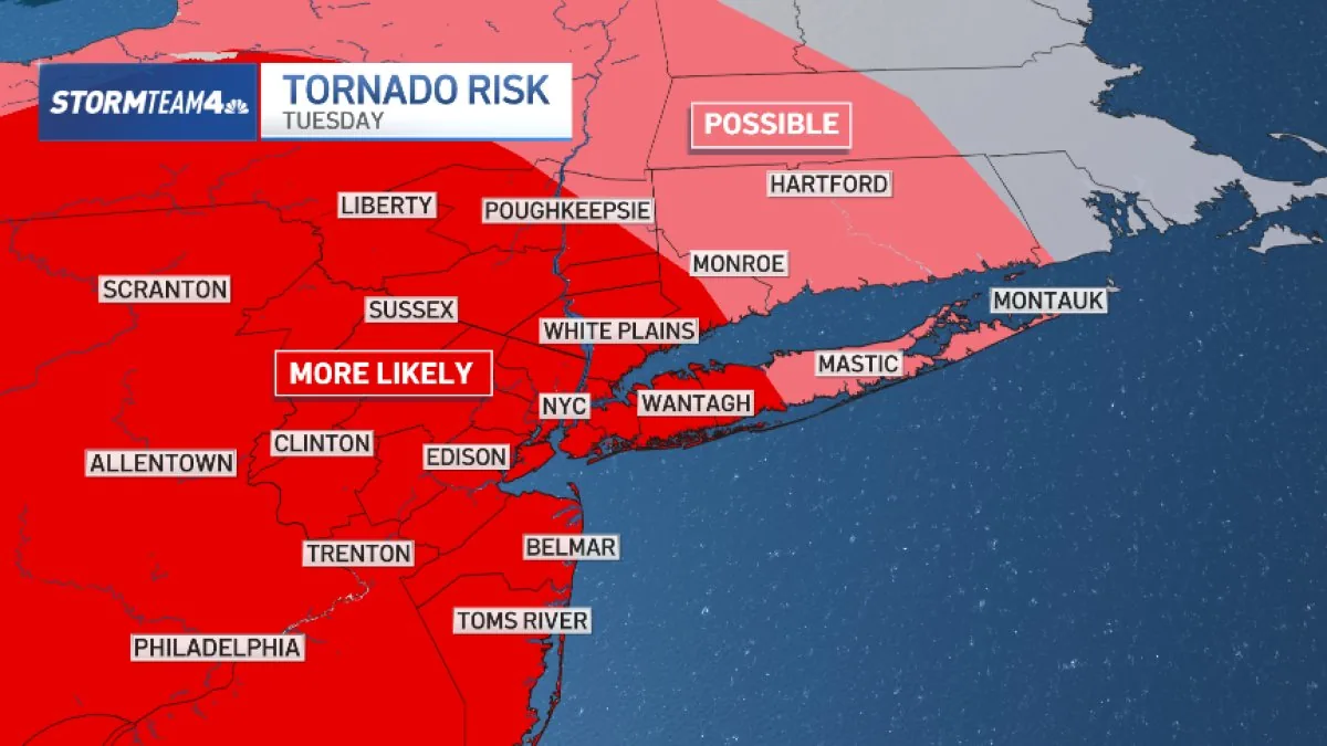
NEW YORK, NY — More severe weather is expected across the tri-state Tuesday, coming just days after a powerful system brought flash flooding and tornado alerts to the region. Forecasters say the day could bring several hazards at once, including damaging wind, hail, flash flooding and an isolated tornado or two.
The main concerns are gusts above 60 mph and pockets of intense rain that could overwhelm low-lying roads, subway corridors and other urban trouble spots.
What are forecasters watching most closely Tuesday?
The strongest storms are expected to produce straight-line wind damage and isolated flash flooding. In the heaviest cells, rain could fall at rates above two inches an hour, which is enough to quickly create dangerous runoff and rising water.
Forecast models also keep hail and brief spin-up tornadoes in the picture, although those threats are considered secondary to wind and flooding.
Where is the flash flood threat highest?
Central and South Jersey face the highest risk of flooding, but the entire tri-state area is under at least a slight risk. Storms will be strongest to the west of New York City, where the hail and tornado chances are also greater.
As the weather moves east, forecasters expect the storms to weaken somewhat, though severe weather remains possible on the New York side of the region.
How will the storms move through the region?
The threat is expected to last most of the day, but rain will not fall continuously. Officials are expecting one, two or even three separate waves of storms from morning through evening, similar to Saturday’s setup.
Conditions should start with more isolated and weaker storms in the morning before becoming more potent and damaging from midday into the evening.
What changes after Tuesday night?
Weather is expected to turn mostly quiet overnight Tuesday, although a few isolated storms could return on Wednesday. There is still a chance of one severe storm east of New York City midweek, but forecasters say the risk of damaging weather will be much lower than on Tuesday.
One possible relief is that Tuesday’s storms are expected to move faster than Saturday’s, which could help keep rainfall totals down and reduce the flood threat overall.
Bronxville News keeps New York and the region covered, day and night.