

TETERBORO, NJ — The Tornado Watch for New Jersey has been canceled, though storms are still expected this evening. Forecasters say the atmosphere has lost energy, which should limit how severe the weather becomes through the rest of the night.
Some storms may linger for a few more hours before tapering off by midnight. Lightning remains a concern, and brief strong gusts are still possible in the stronger cells.
What is expected overnight?
The risk of storms drops sharply after evening, with only lighter showers expected overnight. The main severe weather window appears to be closing as the night goes on.
That means the bigger concern shifts from widespread severe storms to leftover rain and scattered lightning before conditions calm.
How will Sunday look across the state?
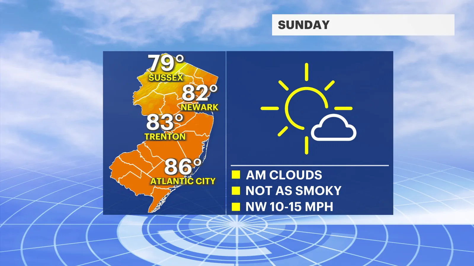
Sunday is forecast to be sunny and warm, with temperatures in the low to mid-80s. Morning lows are expected to start near 70, making for a mild start to the day.
Wildfire smoke is still expected to linger over the region, but forecasters say concentrations should be much lower than in recent days.
What changes are coming Sunday night and Monday?
Sunday night should turn much cooler, with lows in the low 60s. That will set up a fresher start to Monday morning before temperatures climb again.
By Monday afternoon, highs are expected to return to the mid-80s, and forecasters say no immediate problems are expected as of Saturday evening.
When could thunderstorms return?
The next round of thunderstorms is expected Tuesday. For now, the forecast suggests a quiet stretch after the evening storms wind down and the weekend stays mostly settled.
Residents should still watch for lightning tonight and stay alert for changing conditions if any stronger showers hold together longer than expected.
Bronxville News keeps New York and the region covered, day and night.